File:DelMar.png
From CSDMS
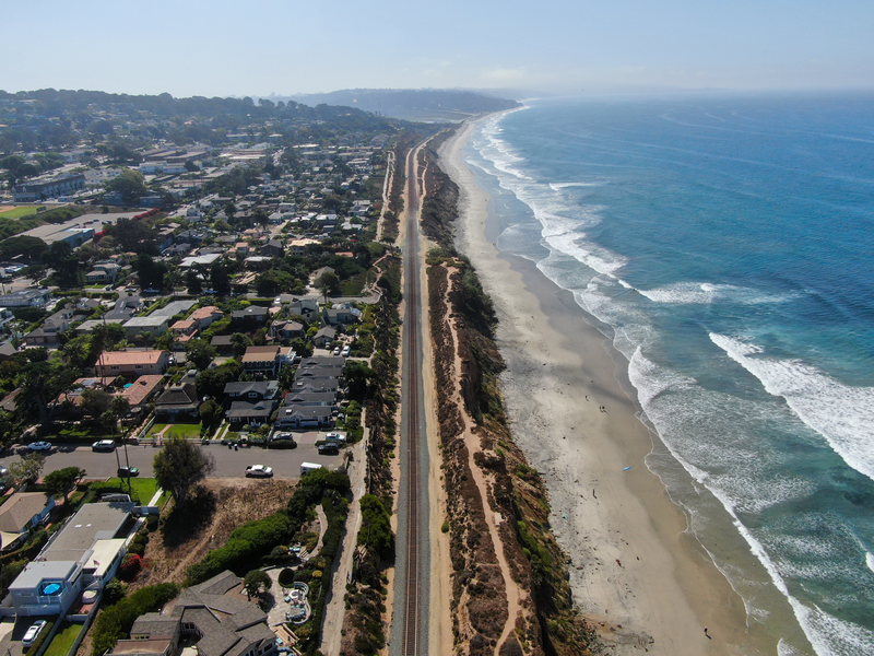
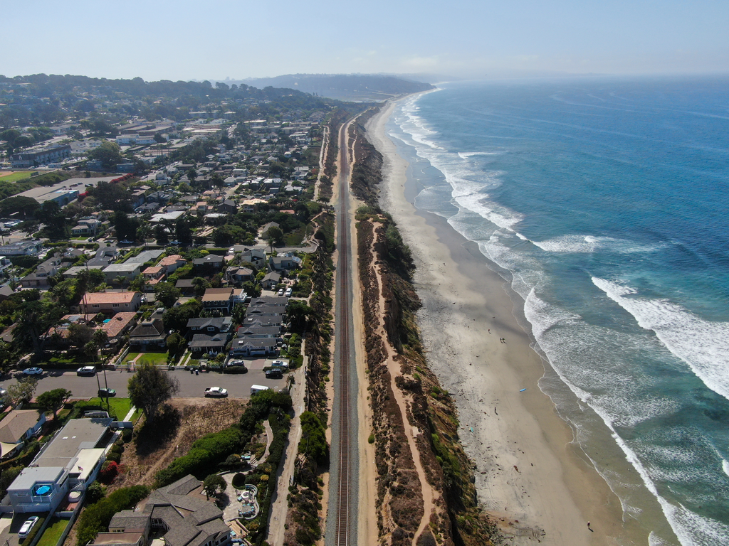
Revision as of 14:18, 28 April 2021 by Travisclow (talk | contribs) (Aerial image looking south of coastal Del Mar, southern California. Infrastructure (homes) and a train that runs between Los Angeles in San Diego are directly situated on top of a ~20m tall sandstone cliff that is subject to wave attack, subtidal, and subaerial erosion, leading to cliff retreat.)

Size of this preview: 800 × 600 pixels. Other resolutions: 1,024 × 768 pixels | 4,000 × 3,000 pixels.
Original file (4,000 × 3,000 pixels, file size: 17.78 MB, MIME type: image/png)
Aerial image looking south of coastal Del Mar, southern California. Infrastructure (homes) and a train that runs between Los Angeles in San Diego are directly situated on top of a ~20m tall sandstone cliff that is subject to wave attack, subtidal, and subaerial erosion, leading to cliff retreat.
File history
Click on a date/time to view the file as it appeared at that time.
| Date/Time | Thumbnail | Dimensions | User | Comment | ||
|---|---|---|---|---|---|---|
| delete all | current | 14:18, 28 April 2021 | | 4,000 × 3,000 (17.78 MB) | Travisclow (talk | contribs) | Aerial image looking south of coastal Del Mar, southern California. Infrastructure (homes) and a train that runs between Los Angeles in San Diego are directly situated on top of a ~20m tall sandstone cliff that is subject to wave attack, subtidal, and subaerial erosion, leading to cliff retreat. |
You cannot overwrite this file.
File usage
There are no pages that use this file.
