2023 CSDMS meeting-014: Difference between revisions
From CSDMS
No edit summary |
No edit summary |
||
| Line 67: | Line 67: | ||
{{CSDMS meeting abstract template 2023 | {{CSDMS meeting abstract template 2023 | ||
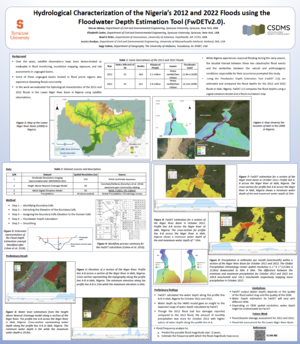
|CSDMS meeting abstract=Globally, the occurrence of extreme hydrologic events such as flooding is known to be the widespread aftermath of torrential rain and the impacts are adverse and devastating in built areas with proximity to water bodies. An example is the 2012 and 2022 flooding along the Niger and Benue rivers in Nigeria. While Nigeria experiences seasonal flooding during the rainy season, the decadal interval between these two catastrophic flood events and the similarities between the natural and anthropogenic conditions responsible for their occurrence prompted this study. Additionally, some hydrologic characteristics and attributes of these flood events are yet to be evaluated. Hence, for the 2012 and 2022 floods, we estimated and compared the floodwater depths at different sections of the Niger and Benue Rivers using the Floodwater Depth Estimation Tool (FwDETv2.0 and FwDETv2.1) implemented in Google Earth Engine, Jupyter Notebook, and ArcGIS Pro. Since this algorithm requires minimal input (flood inundation map and Digital Elevation Model) which favors data-sparse regions such as Nigeria, the potential for the FwDET tool to automatically quantify flood water depths, an important variable in flood intensity estimation was assessed. This tool could be invaluable in flood management and mitigation studies along the rivers. | |CSDMS meeting abstract=Globally, the occurrence of extreme hydrologic events such as flooding is known to be the widespread aftermath of torrential rain and the impacts are adverse and devastating in built areas with proximity to water bodies. An example is the 2012 and 2022 flooding along the Niger and Benue rivers in Nigeria. While Nigeria experiences seasonal flooding during the rainy season, the decadal interval between these two catastrophic flood events and the similarities between the natural and anthropogenic conditions responsible for their occurrence prompted this study. Additionally, some hydrologic characteristics and attributes of these flood events are yet to be evaluated. Hence, for the 2012 and 2022 floods, we estimated and compared the floodwater depths at different sections of the Niger and Benue Rivers using the Floodwater Depth Estimation Tool (FwDETv2.0 and FwDETv2.1) implemented in Google Earth Engine, Jupyter Notebook, and ArcGIS Pro. Since this algorithm requires minimal input (flood inundation map and Digital Elevation Model) which favors data-sparse regions such as Nigeria, the potential for the FwDET tool to automatically quantify flood water depths, an important variable in flood intensity estimation was assessed. This tool could be invaluable in flood management and mitigation studies along the rivers. | ||
|CSDMS meeting posterPDF= CSDMS_2023_up.pdf | |||
|CSDMS meeting posterPNG= CSDMS_2023_up.png | |||
|CSDMS meeting | |||
}} | }} | ||
{{blank line template}} | {{blank line template}} | ||
Latest revision as of 16:32, 25 May 2023
(if you haven't already)
Log in (or create account for non-CSDMS members)
Forgot username? Search or email:CSDMSweb@colorado.edu
Browse abstracts
=Hydrological Characterization of the Nigeria’s 2012 and 2022 Floods using the Floodwater Depth Estimation Tool (FwDETv2.0). =
Dorcas Idowu,
Syracuse University Syracuse New York, United States. doidowu@syr.edu
Elizabeth Carter, Syracuse University Syracuse New York, United States. ekcarter@syr.edu
Brad Peter, University of Arkansas Fayetteville Arkansas, United States. bradp@uark.edu
Jessica Boakye, University of Massachusetts Amherst Amherst Massachusetts, United States. jboakye@umass.edu
Sagy Cohen, The University of Alabama, Tuscaloosa Tuscaloosa Alabama, United States. sagy.cohen@ua.edu
Globally, the occurrence of extreme hydrologic events such as flooding is known to be the widespread aftermath of torrential rain and the impacts are adverse and devastating in built areas with proximity to water bodies. An example is the 2012 and 2022 flooding along the Niger and Benue rivers in Nigeria. While Nigeria experiences seasonal flooding during the rainy season, the decadal interval between these two catastrophic flood events and the similarities between the natural and anthropogenic conditions responsible for their occurrence prompted this study. Additionally, some hydrologic characteristics and attributes of these flood events are yet to be evaluated. Hence, for the 2012 and 2022 floods, we estimated and compared the floodwater depths at different sections of the Niger and Benue Rivers using the Floodwater Depth Estimation Tool (FwDETv2.0 and FwDETv2.1) implemented in Google Earth Engine, Jupyter Notebook, and ArcGIS Pro. Since this algorithm requires minimal input (flood inundation map and Digital Elevation Model) which favors data-sparse regions such as Nigeria, the potential for the FwDET tool to automatically quantify flood water depths, an important variable in flood intensity estimation was assessed. This tool could be invaluable in flood management and mitigation studies along the rivers.