2018 CSDMS meeting-046: Difference between revisions
(Created page with "{{CSDMS meeting personal information template-2018 |CSDMS meeting first name=Sagy |CSDMS meeting last name=Cohen |CSDMS meeting institute=University of Alabama |CSDMS meeting...") |
No edit summary |
||
| Line 33: | Line 33: | ||
{{CSDMS meeting abstract template 2018 | {{CSDMS meeting abstract template 2018 | ||
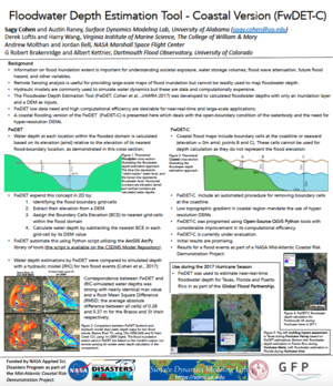
|CSDMS meeting abstract=Information on flood inundation extent is important for understanding societal exposure, water storage volumes, flood wave attenuation, future flood hazard, and other variables. A number of organizations now provide flood inundation maps based on satellite remote sensing. These data products can efficiently and accurately provide the areal extent of a flood event, but do not provide floodwater depth, an important attribute for first responders and damage assessment. Here we present a new methodology and a GIS-based tool, the Floodwater Depth Estimation Tool (FwDET), for estimating floodwater depth based solely on an inundation map and a digital elevation model (DEM). We compare the FwDET results against water depth maps derived from hydraulic simulation of two flood events, a large-scale event for which we use medium resolution input layer (10 m) and a small-scale event for which we use a high-resolution (LiDAR; 1 m) input. Further testing is per- formed for two inundation maps with a number of challenging features that include a narrow valley, a large reservoir, and an urban setting. The results show FwDET can accurately calculate floodwater depth for diverse flooding scenarios but also leads to considerable bias in locations where the inundation extent does not align well with the DEM. In these locations, manual adjustment or higher spatial resolution input is required. | |CSDMS meeting abstract=Information on flood inundation extent is important for understanding societal exposure, water storage volumes, flood wave attenuation, future flood hazard, and other variables. A number of organizations now provide flood inundation maps based on satellite remote sensing. These data products can efficiently and accurately provide the areal extent of a flood event, but do not provide floodwater depth, an important attribute for first responders and damage assessment. Here we present a new methodology and a GIS-based tool, the Floodwater Depth Estimation Tool (FwDET), for estimating floodwater depth based solely on an inundation map and a digital elevation model (DEM). We compare the FwDET results against water depth maps derived from hydraulic simulation of two flood events, a large-scale event for which we use medium resolution input layer (10 m) and a small-scale event for which we use a high-resolution (LiDAR; 1 m) input. Further testing is per- formed for two inundation maps with a number of challenging features that include a narrow valley, a large reservoir, and an urban setting. The results show FwDET can accurately calculate floodwater depth for diverse flooding scenarios but also leads to considerable bias in locations where the inundation extent does not align well with the DEM. In these locations, manual adjustment or higher spatial resolution input is required. | ||
|CSDMS meeting posterPDF=Cohen CSDMS POSTER May2018.pdf | |||
|CSDMS meeting posterPNG=Cohen CSDMS POSTER May2018.png | |||
}} | }} | ||
{{blank line template}} | {{blank line template}} | ||
Latest revision as of 09:12, 23 May 2018
Log in (or create account for non-CSDMS members)
Forgot username? Search or email:CSDMSweb@colorado.edu
Browse abstracts
The Floodwater Depth Estimation Tool (FwDET)
Information on flood inundation extent is important for understanding societal exposure, water storage volumes, flood wave attenuation, future flood hazard, and other variables. A number of organizations now provide flood inundation maps based on satellite remote sensing. These data products can efficiently and accurately provide the areal extent of a flood event, but do not provide floodwater depth, an important attribute for first responders and damage assessment. Here we present a new methodology and a GIS-based tool, the Floodwater Depth Estimation Tool (FwDET), for estimating floodwater depth based solely on an inundation map and a digital elevation model (DEM). We compare the FwDET results against water depth maps derived from hydraulic simulation of two flood events, a large-scale event for which we use medium resolution input layer (10 m) and a small-scale event for which we use a high-resolution (LiDAR; 1 m) input. Further testing is per- formed for two inundation maps with a number of challenging features that include a narrow valley, a large reservoir, and an urban setting. The results show FwDET can accurately calculate floodwater depth for diverse flooding scenarios but also leads to considerable bias in locations where the inundation extent does not align well with the DEM. In these locations, manual adjustment or higher spatial resolution input is required.
