File:Perkins CSDMS ModelComp.png
From CSDMS
Size of this preview: 529 × 599 pixels. Other resolutions: 678 × 768 pixels | 1,268 × 1,436 pixels.
Original file (1,268 × 1,436 pixels, file size: 961 KB, MIME type: image/png)
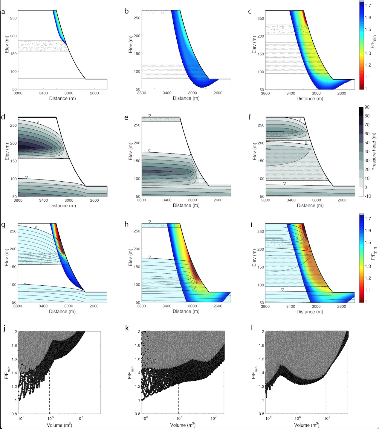
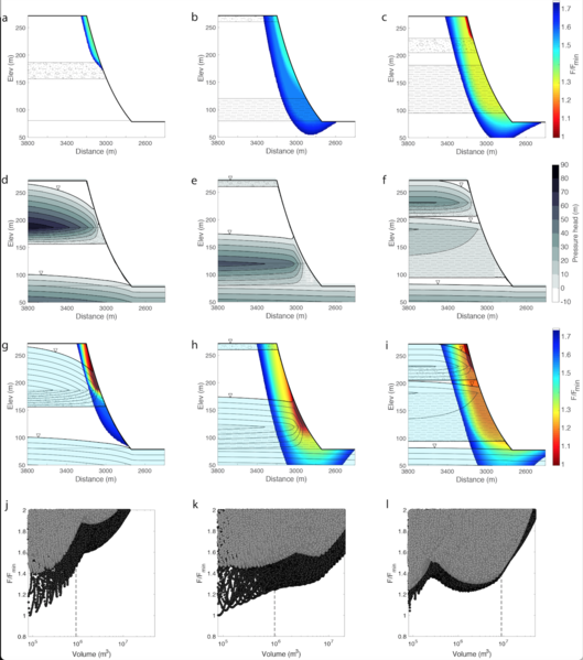
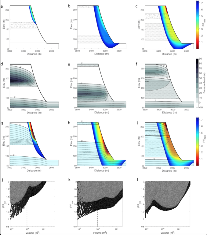
Model results for the Cedar (left column: a,d,g,j), Skagit (middle column: b,e,h,k), and North Fork Stillaguamish (right column: c,f,i,l) stratigraphic configurations. a-c show the relative subsurface factor of safety for dry model runs. d-f show groundwater flow fields from VS2Dt simulations. g-i show relative subsurface factor of safety for VS2Dt model runs. j-l show the calculated volume and factor of safety for each potential failure plane modeled in Scoops3D.
File history
Click on a date/time to view the file as it appeared at that time.
| Date/Time | Thumbnail | Dimensions | User | Comment | ||
|---|---|---|---|---|---|---|
| delete all | current | 21:14, 27 February 2017 | | 1,268 × 1,436 (961 KB) | WikiSysop (talk | contribs) | |
| delete | 20:02, 27 February 2017 | Error creating thumbnail: File with dimensions greater than 12.5 MP | 3,600 × 4,088 (1.66 MB) | Jperkins (talk | contribs) | Model results for the Cedar (left column: a,d,g,j), Skagit (middle column: b,e,h,k), and North Fork Stillaguamish (right column: c,f,i,l) stratigraphic configurations. a-c show the relative subsurface factor of safety for dry model runs. d-f show groun... |
You cannot overwrite this file.
File usage
The following page uses this file:
