File:Fig1 CatchmentLocations.png
From CSDMS
Size of this preview: 624 × 599 pixels. Other resolution: 957 × 919 pixels.
Original file (957 × 919 pixels, file size: 153 KB, MIME type: image/png)
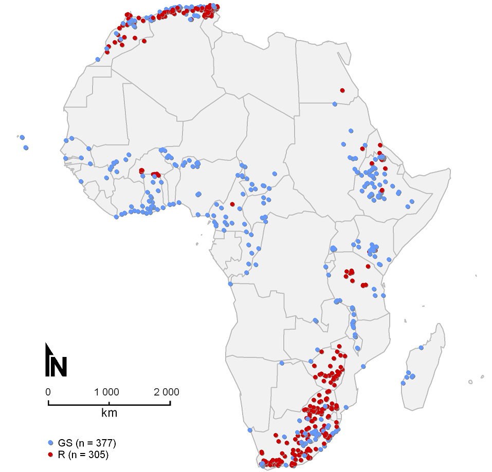
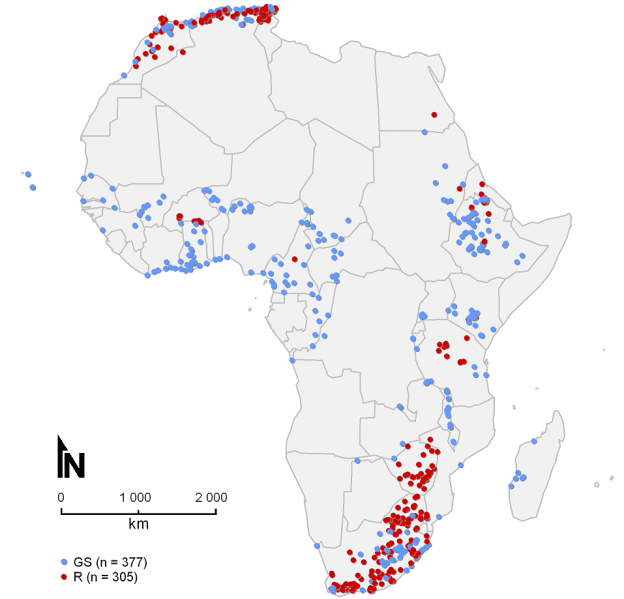
Spatial distribution of the catchment outlets for which sediment yield (SY)observations are available. GS: SY was derived from gauging station measurements. R: SY was derived from reservoir sedimentation rates.
File history
Click on a date/time to view the file as it appeared at that time.
| Date/Time | Thumbnail | Dimensions | User | Comment | ||
|---|---|---|---|---|---|---|
| delete all | current | 03:22, 1 August 2014 | | 957 × 919 (153 KB) | Matthiasvanmaercke (talk | contribs) | Spatial distribution of the catchment outlets for which sediment yield (SY)observations are available. GS: SY was derived from gauging station measurements. R: SY was derived from reservoir sedimentation rates. |
You cannot overwrite this file.
File usage
The following 3 pages use this file:
